


England’s most northerly and least populated National Park is 400 square miles of Northumberland's glorious countryside, protected for its wildlife, tranquillity, biodiversity, dark skies and clean water. Stretching from Hadrian's Wall to the Scottish Border it encompasses the high moors and picturesque valleys of Tynedale, Redesdale and Coquetdale and the impressive hills of Simonside and the Cheviots.
The National Park is sublime walking, cycling and exploring country. Here are some wonderful days out in and around the Heart of Hadrian’s Wall.
Hadrian’s Wall – The National Trail and Cycle Path
You can walk the entire length of Hadrian’s Wall, end to end, for the first time in over 1600 years on the Hadrian's Wall National Trail. The Wall itself can be seen at numerous locations with the most spectacular sections between Birdoswald in Cumbria and Housesteads in Northumberland National Park. Every aspect of Roman life on and around the Wall is on display in museums and forts along the length of the Wall. This includes Vindolanda Roman Fort, home to the famous ‘Roman Postcards’, where you can often watch archaeologists unearthing treasures from the past, and at Housesteads Roman Fort. The Hadrian’s Wall bus runs between all the main car parks along the wall, allowing you to leave the car, walk a stretch and get the bus back.
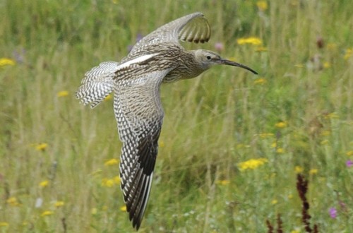
The Hadrian’s Cycleway runs the length of the Wall between Maryport on the West coast and Newcastle-upon-Tyne on the East coast. This exciting cycleway passes through picturesque market towns and villages as well as passing historic Roman forts. This area is dominated by the dramatic whin sill ridge along which Hadrian’s Wall is built. This rock was here 295 million years before the Romans! Look out for rare whin grassland with species such as wild chive and biting stonecrop. Below the rocky ridge are deep peat habitats where sphagnum moss, bog rosemary and bog asphodel grow. Birds such as golden plover and dunlin can be seen, together with the large heath butterfly. Loughs (fresh water glacial lakes) are also found here, look out for whooper swan, golden eye, teal and wintering geese. The loughs are also home to native white-clawed crayfish.
Hadrian’s Wall - Natural Beauty
The central, most scenic section of Hadrian’s Wall runs along the southern boundary of Northumberland National Park. At its western corner, is the village of Greenhead with its cosy, open-fired pub/restaurant (The Greenhead Hotel) and welcoming Old Forge Tea Shop. On the 2nd Sunday of every month, 10am-2pm, is the Hadrian’s Wall all-organic Farmers Market with local food and crafts. A pretty walk along the Tipalt Burn – studded with snowdrops in early spring, brings you to the picturesque ruins of Thirlwall Castle and onwards into a young woodland. A few miles east along the military road (B6318) from Greenhead the Roman Army Museum houses fascinating exhibits. Opposite is the recreation area of Walltown, once a Victorian quarry and now restored to nature by Northumberland National Park. Wonderful for all ages, there is a cafe and picnic area, a willow maze, wildflower meadows with orchids in summer, lakes and walkways and a great climb to Hadrian’s Wall at Walltown Crags. The Hadrian’s Wall Bus (AD122) stops here with a daily service from Hexham between Easter and October.
Follow the signs from the B6318 opposite the Milecastle Inn to discover Cawfields, another former quarry cutting dramatically through the Wall and the underlying Whin Sill bedrock. With a large pond and car park and good walking access to Roman Milecastle 42, it is a good picnic spot. Its encircling cliffs makes it a favourite stargazing spot for the Newcastle Astronomical Society who regularly hold public events here and it has been declared an International Dark Sky Discovery Site. There is a bus stop for the Hadrian’s Wall Bus outside the Milecastle Inn.
The highest point of Hadrian’s Wall is Winshields Crag and east of it one of the best views of the Wall at Steel Rigg – easily accessible from the National Park car park along a footpath suitable for wheelchairs. From here it is a thigh-stretching up-and-down walk with glorious views of the loughs at the base of the north-facing cliffs, to the Housesteads Roman fort with its newly-refurbished museum. This walk is a real treat, for as well as 360 degrees of breathtaking scenery, the path cuts through conserved grassland vibrant with the rich hues of alpine flowers in summer.
Continue north on the road past steel Rigg and you will come to a small parking area where a rough permissive path through farmland leads to Greenlee Lough National Nature Reserve with its long boardwalk through the reed beds and fen to the lough and its bird hide. Greenlee Lough is used as winter feeding site for several species of wildfowl including ducks, teal, wigeon and goldeneye and whooper swans. In summer mute swans and mallards breed and if you are lucky you may see an otter or a roe deer.
The boardwalk was installed to protect the fragile wet habitats on the edge of the lough. Specialist plants that thrive in wet peaty habitats are found around the boardwalk including sphagnum mosses, cranberry, bog asphodel, marsh cinquefoil, marsh marigold, devils-bit scabious and in the wettest areas common reed. Download a walk guide.
A short walk south (downhill) from Steel Rigg to the military road brings you to the National Park Once Brewed visitor centre, open 7 days from Easter to October and weekends during the winter. Next door is the warm welcome of the Twice Brewed Inn, and a short bus ride south is the outstanding museum and archaeological site of Vindolanda.
Beyond the Wall
The countryside of Northumberland National Park changes from moor to valley as you head north – each river with its own special character. The North Tyne valley, the route to Kielder Water and Forest Park, is packed with little stops of charm and pleasure. The ancient flowering hay meadows of the valley are spectacular in the summer and the river is renown for its fly fishing.
The small villages of Simonburn with its flowery tea rooms and Stonehaugh, with its fine picnic area on the Warksburn, are both worth a detour. The same road brings you to Bellingham, a thriving village with shops, eateries, campsite, an accoustic music club and a good golf course. Not to be missed on a visit hear is the Bellingham Heritage Centre – an award-winning museum of the life of the valley through its rural and industrial past – including its former life as a railway station with classic carriages in the yard housing exhibits and a good tea room. Just outside the village is Hareshaw Linn - a gorge with an ancient woodland, home to red squirrels and all kinds of rare woodland plants, ferns and lichens. The walk up the gorge across its six bridges is a short expedition that children love and takes you to a fine waterfall or linn and the end.
Upstream the rural community of Tarset sits in a stretch of beautiful countryside. Walks have been created to discover the old Riever bastles, and through the beech woods of Sidwood on the outskirts of Kielder Forest. Just before you get to the Kielder Dam, make a detour to the village of Falstone and its friendly Old School Tea Room and pretty community picnic garden opposite. For children, there is a really well-equipped playground just behind the village hall, and for all ages, a pleasant circular walk along the river gives you a chance to admire the hay meadows and takes you past the community sculpture of The Stell – a stone settee with a tale to tell!
There’s much more to explore and discover if you go further. Find out what to see on our website http://www.northumberlandnationalpark.org.uk/visiting.